Monday, December 21, 2015

Guayaquil

I arrived in Guayaquil late on Friday after a looong day of travel, and had a few days to settle in before going to the Galapagos.  It is hot, humid, and uncomfortable here ... and I am loving it.  Goodbye, Sacramento winter.

I thought about taking a tour to orient myself to Guayaquil, but although it is a large city, it was not hard to walk around by myself.  On Saturday, I headed for the malecon (river walk) and joined the weekend throngs in strolling.

Resultado de imagen para guayaquil turistico

Then I headed back into the city where I discovered that the traffic is terrible - complete gridlock.  Walking looked better and better.

Like most Latin cities, there is a cathedral with a park in front.  But this park is a bit unique as it is inhabited by land iguanas.


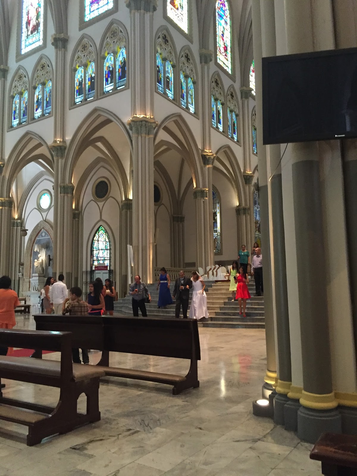
It was a busy Saturday in the cathedral.  First I attended a wedding and then a christening.  No food served, unfortunately, so I wasn't much of a wedding crasher.


Then it was back to the malecon where Pepsi is sponsoring Christmas.  Besides the giant tree, there are food booths, rides for the kids, and several nativity scenes.  Papa Noel (Santa) sits on a stage wearing a blue suit.  Children sit on his lap and their parents take pictures.  No need to pay Santa's elves for the privilege of a picture.  Of course, Pepsi sponsors Santa as well.  The sign says:  De: Pepsi, Para: Ti.  From Pepsi for you.


At night there was a parade with floats and dancers.  I'm not sure that I have seen a nighttime parade before.  All of the floats were decorated with lights, as were the dancers and musicians.  The streets and buildings here are not decorated with Christmas lights, but the parade was a moving Christmas light show.  The first float, of course, was a manger scene, but then they got pretty creative:  white Christmas with Frosty, the Polar Express, Snow White and the Seven Dwarfs, and Peter Pan.  They must have some different traditions here.  I do hear all the "traditional" Christmas songs such as I'm Dreaming of a White Christmas, Jingle Bells, and Frosty the Snowman.  It never ceases to amaze me how the concept of snow at Christmas time has taken over, even in warm climates.

On Sunday I headed in the other direction on the Malecon.  First I visited the Guayaquil Miniature Museum where I learned the history of Guayaquil.  More interesting than I would have thought, and a good Spanish lesson as I read all of the explanations in Spanish.  Sometimes I cheated, however, and listened to the English narration.  The most disturbing thing that I learned:  The Spanish headed for Quito and the mountains because they wanted gold and silver.  Guayaquil on the coast was a backwater - poor and subject to constant raids from pirates.  The worst raid was carried out by a pirate named ... wait for it ... Picard.  Say it ain't so, Jean Luc.  What was Gene Roddenbury thinking?

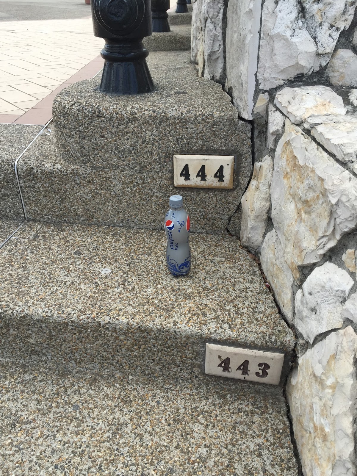
Then I headed for Cerro Santa Ana (Santa Ana Hill) with its colorful buildings and lighthouse on top with 360 degree views of the city.  There are 444 steps to the top, helpfully numbered so you know how far you have to go.  The numbers are for everyone, but the Pepsi Light (South American DP) is all mine, although at only 400 ml, it is barely a sip.  And the 444 does not count the 50 steps to the top of the lighthouse.  I had to count them myself.  Apparently Cerro Santa Ana used to be a pretty sketchy neighborhood, so now there are security guards all along the route.  There are also benches conveniently placed at frequent intervals.  All in all, a very pleasant walk and view.

Image result for guayaquil cerro santa ana


And that was Guayaquil.  Today I waded into the crowded local markets to pick up a few last minute things, and tomorrow morning I am off to the Galapagos.

Monday, July 6, 2015

Nazca ... wow

The sun came out, the fog burned off, and they finally let the planes take off around 11.  The basic flight is half an hour over the Nazca lines, but there is a longer flight that goes over the Nazca and Palpas lines.  There was a minimum of two required for the longer flight so although I requested it, I wasn't sure if I would get it.  Fortunately, Rachel, a young woman from Great Britain who is traveling alone requested the longer flight just yesterday, and she was worried all night whether she would get it.  Obviously ... meant to be.

So while the other hundred people waiting got on "huge" six passenger planes, Rachel and I were escorted to a teeny tiny four seater.  Two pilots in the front (I liked that!); Rachel and me in the back.  It was amazing.

First of all, it was the smoothest ride.  I was a little concerned about the plane bumping around, but while it was noisy, it was a gentler ride than in a car.

Second, I was completely wrong about the terrain.  It is not all flat and dry.  In places where they use the underground water, it is green and lush.  And while much of the lines are on the flat  mesas, there were bare, rocky mountains, and some of the "drawings" were on the sides of the mountains.  Especially the Palpas lines which are even older than the Nazca lines and a little farther away.  They were smaller and mostly on the sides of mountains rather than carved into the ground.  I was glad I got to do the longer ride and see the Palpas lines, too.

Finally, the distances were much bigger than I had imagined.  It often took a few minutes between "drawings."  But the entire surface is marked with more than a thousand criss-crossing lines.  And besides the animals and people, there are huge trapezoidal "fields" that are scrubbed clear with rock borders.  They look like landing strips.

It was just amazing.  Even though I had seen pictures and watched the planetarium show, this is one of those things that you just have to see to believe.  It was well worth the fifteen hour round trip in a car to Nazca.

So, bearing in mind that pictures just don't do this justice ...

My view of the pilot
Looking out my window 
Image result for nazca lines
A perfect hummingbird
Image result for nazca lines
The astronaut on the side of a hill
Image result for nazca lines
Shapes on the ground
Image result for palpas lines
A Palpas family group on the side of a hill.
Image result for palpas lines
The Palpas star
That was it.  A one hour flight was not enough.  We had a long drive back to Lima, stopping for a view of the Nazca irrigation system.  They ran the underground water through channels accessed by wells.  But instead of building a deep well with a bucket dropped into it, they built spiral ramps down to the bottom of the wells.  Like the Inca walls in Cuzco and Macchu Picchu, the original Nazca walls have survived massive earthquakes and the water still flows in the original channels.

Image result for palpas lines

We also stopped in Pisco for a wine tour and tasting.  Pisco is the local alcohol and it is used to make a pisco sour, the national drink.

We arrived back in Lima in the evening where I will spend my last day in Peru.  Hasta luego.


From Cuzco to Nazca


My second week of Spanish school in Cuzco passed quickly.  My classmate was Michelle, the English teacher from Encina who randomly came to the same school as me.  We had classes every morning and in the afternoons, I walked around the city or visited one of the museums.  Walking was a challenge because the streets are so narrow as well as hilly.  A small car can barely fit between the buildings on either side of the street and sidewalks are rarely big enough for two people to walk together or pass each other.  You can't step into the street to pass someone if a car is coming, and even walking on the narrow sidewalks, you are in grave danger of being taken out by the side mirror of a passing van.  Also, the streets are one lane but sometimes two directions.  I would not want to drive here.  The local market has rows for each type of food:  produce, meat, cheese, bread, etc.  This is how you can tell the pork section.


For my last few days in Peru, I had scheduled a three day trip from Lima to the Nazca lines.  My one hour flight from Cuzco to Lima was supposed to leave at 11 Saturday morning, but Lima was fogged in and the planes could not leave to come to Cuzco.  I finally arrived four hours late and was happy I had booked a private guide.  It was nice to walk off the plane so late and see a sign with my name on it.

We drove south on the Pan American Highway for several hours to Paracas, a nature preserve which includes a peninsula, small islands, and the ocean itself.  Lima is like San Francisco: always temperate in climate and usually foggy or cloudy.  But as you drive south, the sun comes out and the land becomes drier and drier.  The Humboldt Current comes up the coast from Antarctica.  If I understood correctly (unlikely), cold water carries more oxygen than warm water, so as it goes north, the water can't condense, so it never rains.  Sounds odd to me but the bottom line is, it never rains.  They get less than 2 millimeters of rain a year here.  So it is bare and sandy land, with frequent wind storms.

Nonetheless, Paracas is incredibly biodiverse.  The water is full of anchovies which are at the bottom of the food chain, so there are lots of fish and larger marine animals.  Paracas is on the migratory route for birds in the Western Hemisphere and also has a large population of native birds.  We took a boat ride out to the islands which are protected because they are a major source of guano.  Dolphins swam alongside us, and on the islands we saw Humboldt penguins, sea lions, and lots of birds.  The Peruvians consider Paracas to be be their little Galapagos.  On the way, we saw our first Nazca lines - a figure that is probably a cactus but is called the Candelabra.  It is huge - on the side of a large hill.

Image result for paracas


Image result for paracas

It's hard to take pictures of birds and small penguins.

The next stop on the way to Nazca was the oasis at Ica.  Again, two millimeters a year of rain.  For some reason there is water underground in some places.  But otherwise, this is the bleakest land that you can imagine.  Nothing grows.  It is not even scrub land.  Just miles and miles of sand and rock.  So if you have lemons, you make ... a sand resort.  We drove in dune buggies up and down the sand dunes.  It was like being on a roller coaster.  We would go up an impossibly steep dune, go over the crest, and drop straight down.  I was in the front seat and it was a white knuckle ride.  Then we stopped at the top of a dune and they gave us boards to go down on.  The first slope was intermediate.  A little scary but I did it.  The second was a baby slope.  Piece of cake.  Then we stopped on top of a black diamond hill.  Straight down.  I got on and the guide gave me a little push, but I looked down the hill and bailed at the last second.  Call me a wuss.


 Finally it was on to Nazca for the main event.  The Nazcas predate the Incas by 1,000 years or more.  The area they lived in is completely flat - like a huge mesa - and it never rains here either.  Complete desert.  So for some reason that no one knows, the Nazcas etched out lines and figures in the earth.  And because of the unique climate and topography, the lines never go away.  And ... you can really only see them from the sky.  The lines were unknown for centuries until commercial flights started to fly over the land in the 1920's.  Of course one theory is that these were really made by ET's.  Why else have figures that can only be seen from the sky?  Another theory is that the lines were for the gods.  Some of the lines line up with sunrise or sunset on the winter or summer solstice, so they apparently knew something about astronomy.

We stopped at a tower and a small hill and I got my first view of some simple lines and forms.  Then I went to a fascinating planetarium show last night that focused on the lines but also a little about the southern skies.  A few days ago I realized that even though I go south every winter to warm weather, this is the first time that I have been south of the Equator.  I'm glad I wasn't a seaman on a ship having to undergo a hazing ritual.  I also realized that I had neglected to look up at night and see the Southern Cross for the first time.  So the planetarium show was perfect.  The guide took us outside first and pointed out constellations including the Southern Cross and the Big Dipper which is very low on the horizon here.  Also, Alpha Centauri, the closest star to the earth is visible in the Southern Hemisphere.  He pointed out three planets in the sky and later set up a telescope so we could see Saturn with its ring and even some of its satellites.

And now I am at the airport in Nazca waiting for my overflight.  It is grey and a bit foggy this morning.  All of the flights are scheduled for 9 AM, but we are just sit around waiting until they say we can have a good view.  This is what I expect to see.

Image result for nazca lines
The monkey

Image result for nazca lines
The spider